6 of the Best Hiking Trails in Los Angeles
You may not initially think of hiking when you think of LA, however, to truly experience Los Angeles, you need to get out on some hiking trails and away from the crowds. My husband and I (and our dog) spent a summer living and working in Los Angeles and we tried to get out on some of these gorgeous LA hikes as often as we could.
Sometimes the freeway traffic (you know you’ll be stuck in freeway traffic at some point while in LA 😅), huge amounts of people, and the hustle and bustle of the city can get to be too much. However, these hikes are sure to be rejuvenating while experiencing some of the best views of the city. Personally, I don’t think any trip to LA is complete without trying one of these six best hikes in Los Angeles.
*There may be affiliate links in this post. Read my privacy/disclosure policy to learn more.
You’ll love this post: 7 Perfect Beaches in Los Angeles You’ve Got to Visit
6 of the Best Hiking Trails in Los Angeles
1. Runyon Canyon North Entrance
- Length: Choose your length (1-4 miles) Start at Mulholland Drive North Entrance
- Difficulty: Moderate
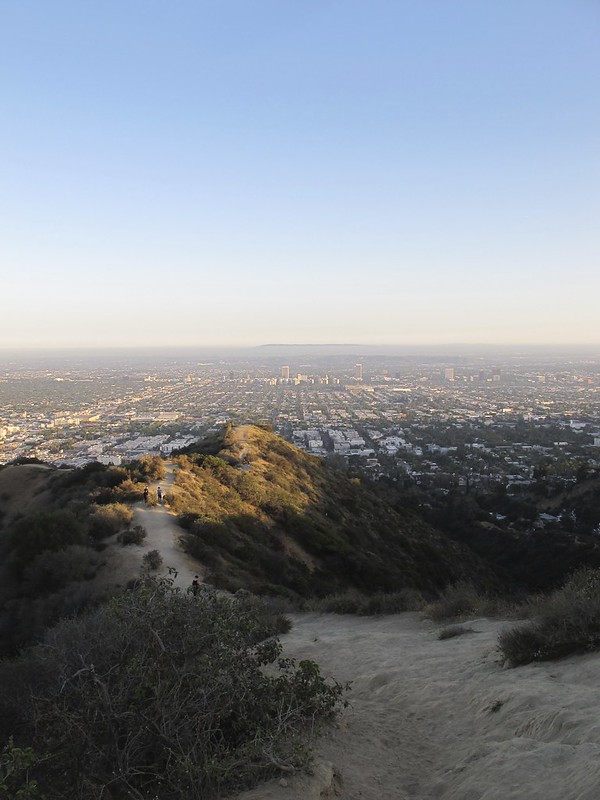
Hiking or trail running on LA’s Runyon Canyon Trail is one of the top things to do in Los Angeles and one of the best hiking trails in Los Angeles. Runyon Canyon is known as an oasis away from the city but with amazing views of Hollywood, downtown LA, and the infamous Hollywood sign. This LA hike is a go-to for Los Angeles locals so you know it’s got to be good.
Runyon Canyon is a large trail system on 160-acres with multiple entrances and a couple of types of trails (a paved fire road and a more traditional dirt trail). You can hike for 3+ miles, or hike for only one mile and still get incredible views (if you start at the right place).
Something crazy about hiking amongst the LA locals is overhearing their interesting conversations. Multiple times when on the trail we overheard people talking about casting calls, recent photoshoots, and their dreams of being an actress/actor. I would turn to my husband and just be like, “Where in the world are we!?”. Only in LA!

Many people start the hike at the bottom of Runyon Canyon meaning they have a complete uphill climb their entire way (and horrible parking options). However, I super, highly recommend starting your hike from the Runyon Canyon North Entrance parking lot right off Mulholland Drive and choosing the dirt trail over the paved trail (you’ll know it when you see it). You will still have plenty of uphills and downhills, but the views are better right off the bat and a more enjoyable hiking experience overall (in my oh-so-humble opinion).
*After your hike, be sure to continue your drive up Mulholland Drive. Mulholland is known for celebrity mansions (seriously these houses are insane) and gorgeous views of LA-you can’t leave LA without seeing more of Mulholland. You will most likely see guided tour busses and vans also taking a drive.
check out this post: 19 Unique Airbnbs in California You Need to Experience
2. Hollywood Sign from Griffith Observatory
- Length: 6 miles roundtrip
- Difficulty: Moderate
- View on AllTrails
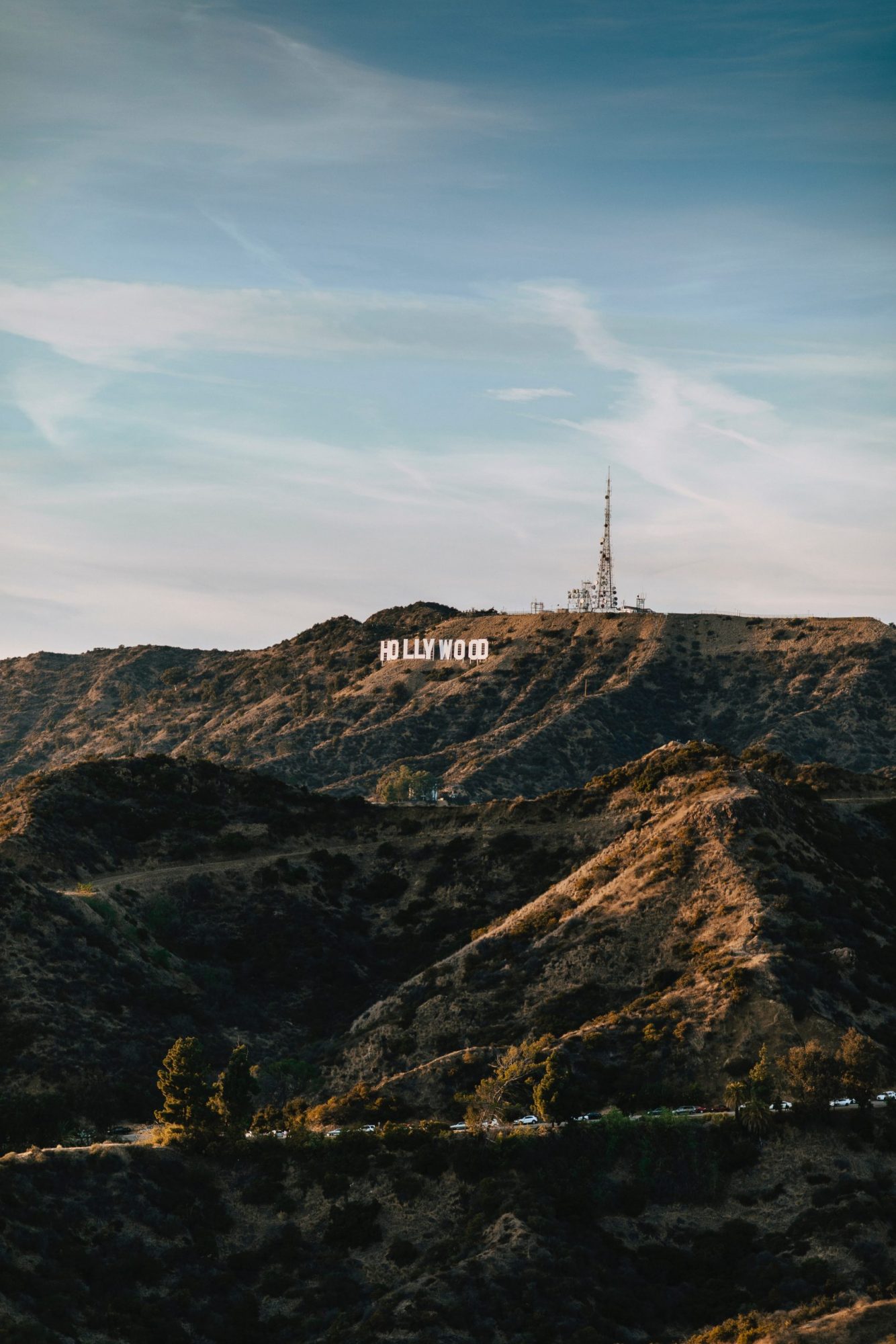
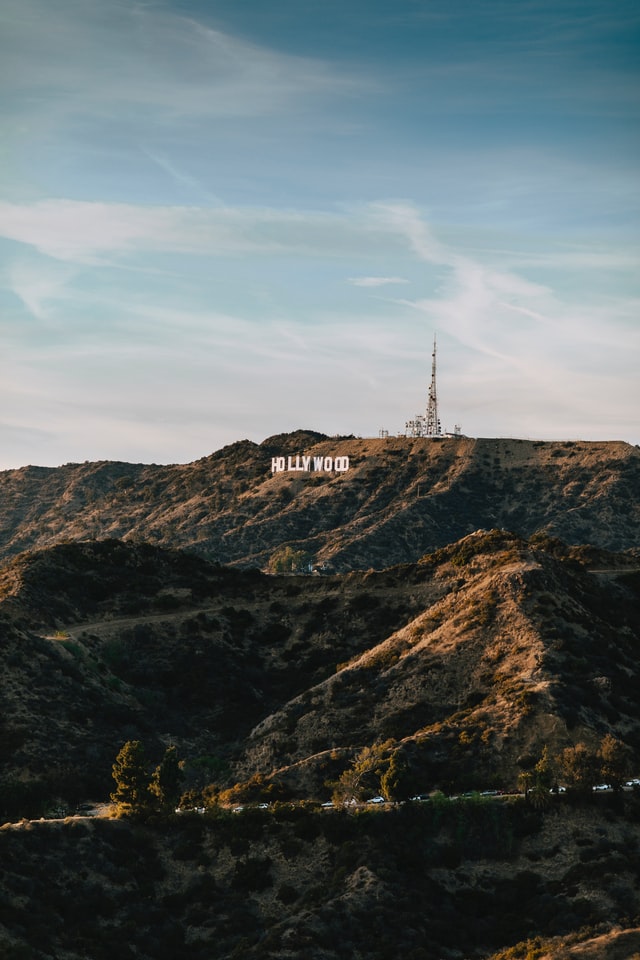
The Hollywood Sign hike takes you up close and personal to one of Los Angeles’s most iconic landmarks. Technically, you can’t actually go right up to the sign itself, but rather right behind and above it – but it’s still such a cool experience!
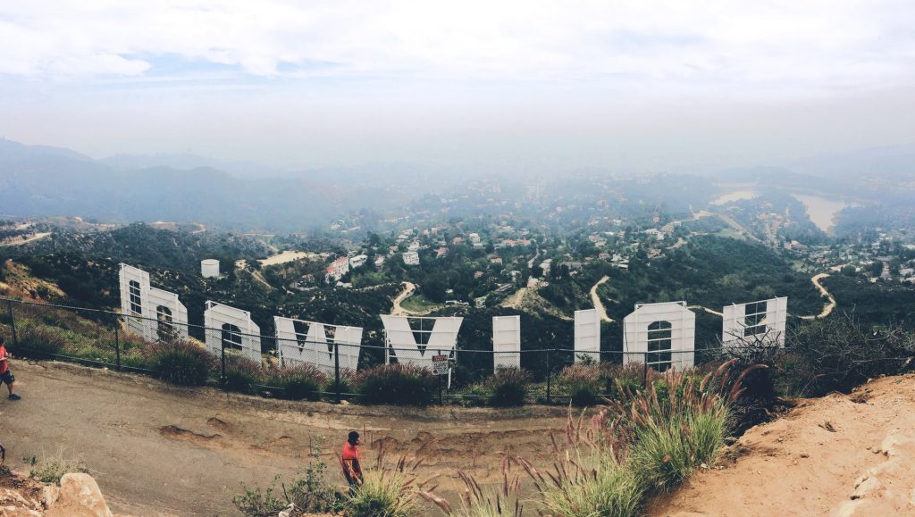
There are several trails that lead up to the Hollywood sign, but the best way (and the most popular) is to use the Brush Canyon trail, which starts from Canyon Drive in Griffith Park. The hike is roughly six miles round-trip and is rated with an 1171-foot elevation gain. If you are worried about finding the correct trail, a great option would be this awesome guided hike to the Hollywood sign. You’ll get insider LA history plus someone to snap perfect pics for you!
Be advised that the trail is in full sun and there is no shade – doing it during the winter months, or earlier in the day is advised. Otherwise, you can attempt the hike around sunset – you’ll get to see the twinkly lights come up on the skyscrapers of the downtown skyline! Either way, though, the view from the top is pretty epic, and you’ll get to experience one of LA’s most iconic hikes.
Written by Caroline of Pictures and Words Blog
related post: 14 Beautiful California State Parks You’ve Got to See
4. Griffith Observatory | Mount Hollywood Trail
- Length: 5.3-mile loop (hike as long or short as you’d like)
- Difficulty Level: Moderate
- View on All Trails
The iconic Griffith Observatory overlooks the great city of Los Angeles, providing expansive views of the downtown skyline below. It is also home to some of the most epic hikes in Los Angeles. While there are several trailheads in Griffith Park, a highly recommended option is the Mount Hollywood Trail, one of the tallest peaks in the park which offers views of both the observatory and the Hollywood sign.
To hear interesting stories and the history of LA while you hike, be sure to check out this highly-rated guided Griffith Observatory hike. This guided hike is a great way to experience the Hollywood Hills.

The Mount Hollywood Trail is a 5.3-mile loop, but hikers are of course welcome to shorten that length by walking part of the trail and heading back. The trail is a clearly marked dirt path, and it leads you up into the hills, passing some amazing viewpoints along the way. Morning or afternoon is the best time for this hike to avoid midday heat and crowds.
Written by Olivia from the Girl With Blue Sails Travel blog
3. Potato Mountain
- Length: 5.2 miles roundtrip
- Difficulty: Easy-Moderate
- View on All Trails
Potato Mountain is located on the outskirts of LA County, in the city of Claremont, California. While it isn’t necessarily one of the prettiest or most challenging hikes in Los Angeles, it IS one of the strangest.

The hike isn’t inherently difficult in terms of terrain, but the length and steepness can be challenging for beginner hikers. Once you reach the summit of Potato Mountain, you will discover the reason behind the name; it is tradition for hikers to write their name on a potato and leave it atop the water reserve at the end of the hike. Dozens of potatoes overlook the valley below, and on a clear day, you may even be able to spot the Pacific Ocean and the San Gabriel mountain range as you sit amongst the starches.
Parking is free, but since the lot isn’t that big, you might want to aim to arrive before 10 am to ensure you get a spot, though the small parking area also means the trail is never too busy or crowded. Almost the entire hike is exposed, another benefit of hiking before peak sun and heat, and be sure to bring about a liter or so of water. Hiking Potato Mountain is easily one of the most memorable hikes in Southern California.
Written by Kay from The Awkward Traveler Travel Blog
read nexT: 16 Best Hiking Shoes, Boots, and Sandals for Women
5. Solstice Canyon Trail Loop
- Length: 3.2 miles roundtrip
- Difficulty: Moderate
- View on Alltrails
Solstice Canyon Loop Trail in Malibu is one of the best hiking trails in Los Angeles to get maximum payoff for minimal effort. This trail gives striking views of the Santa Monica Mountains and the Pacific Ocean and can be done as a slow, leisurely hike to really soak in the views. The reward of this hike is picturesque scenery that embodies everything that makes California great.
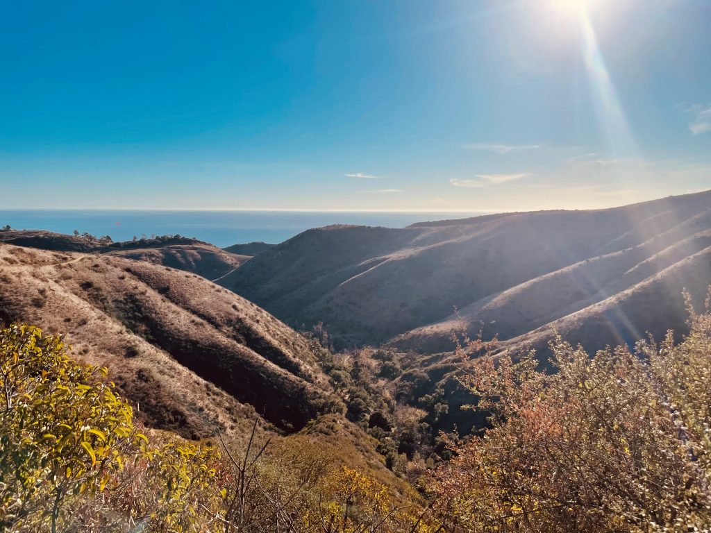
Starting at the trailhead, there will be gradual elevation gain and mountain views as you begin your journey. Early on in the hike, there is a small waterfall which you can access from a trail offshoot. From there, the trail will begin to have slightly more elevation gain until you reach the top for beautiful views of wildflowers, peaks and valleys, and the blue ocean as far as your eyes can see.
The trail is beautiful year-round, one of the perks of hiking in Southern California. If you can, go on a weekday to avoid the crowds. Be sure to bring a cap and sunscreen as shade is sparse on this hike. And of course, bring along plenty of water and snacks, and also be prepared for spotty cell reception. Aside from that, just enjoy yourself!
Written by Sumeeta Seeks
6. Mount Baldy
- Length: 11-mile loop
- Difficulty: Strenuous
- View on AllTrails
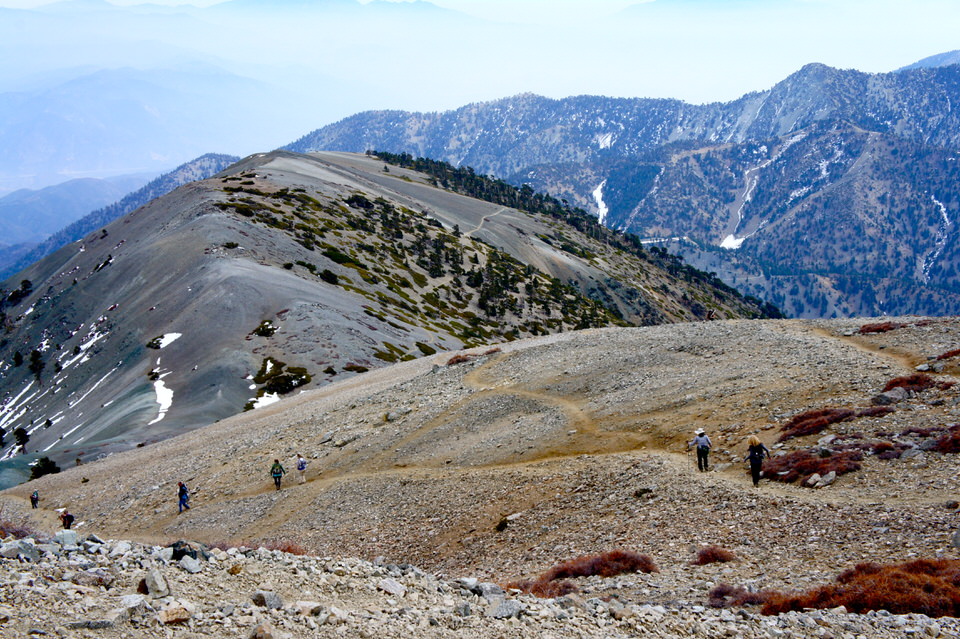
If you want to combine a leg-burning workout along with gorgeous views, head one hour northeast of LA to the Angeles National Forest and hike Mount Baldy. Part of the San Gabriel Mountain range, Mount Baldy (also known as Mount San Antonio) is the highest peak in Los Angeles County with an elevation of 10,064 feet.

The Mount Baldy hike begins at the Manker Flats Trailhead, and you have a couple of trail options, but I highly recommend doing a loop by taking the Baldy Bowl Ski Hill trail on the way up and the Devil’s Backbone Trail on the way down. This loop gives you more of a challenge with steep elevation gain, making it an awesome training hike for bigger objectives like 14ers.
If you go down the Devil’s Backbone trail, you’ll go through Mount Baldy Ski Area, giving you the option to take a break and have a hearty meal at the Top of the Notch Restaurant there. Or, if you’re totally exhausted, you can even take a ride down the ski lift ($25 round trip) instead of hiking all the way down.
Written by Allison of She Dreams of Alpine
Check out these other posts, I know you’ll love them:
- 7 Perfect Beaches in Los Angeles You’ve Got to Visit
- 19 Unique Airbnbs in California You Need to Experience
- 7 Things to Know Before Bouldering In Joshua Tree National Park for the First Time
- 14 Beautiful California State Parks You’ve Got to See
- 12 Gorgeous Northern California Hikes in the Sierra Nevadas
- 16 Best Hiking Shoes, Boots, and Sandals for Women
And those are the top 6 best hiking trails in Los Angeles! Get out there and enjoy!
Let me know if you have any questions or comments below! I love to talk all things travel-related.

Like it? Pin it!